
November 27, 2013
Nass Peak Glacier Retreat, Coast Mountains, British Columbia
Posted by Mauri Pelto
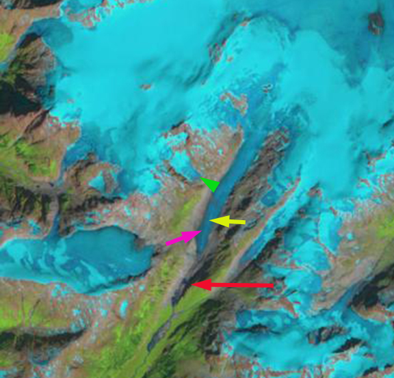
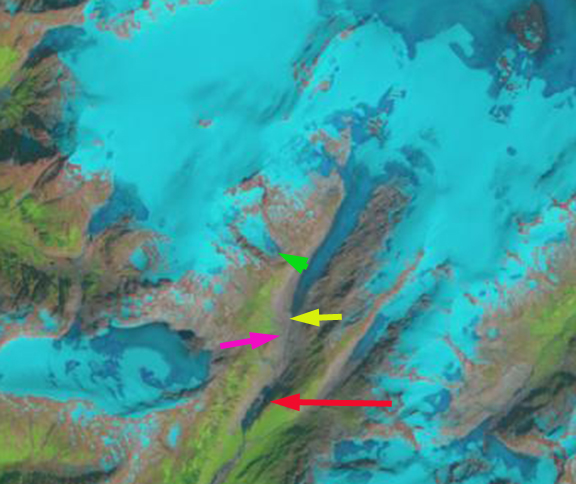
“Nass Peak” Glacier is a 5 km long unnamed valley glacier that feeds Coast Mountain Creek and then Nass River. The closest community is Kitsault, BC on the north side of the small icefield from which the glacier originates. 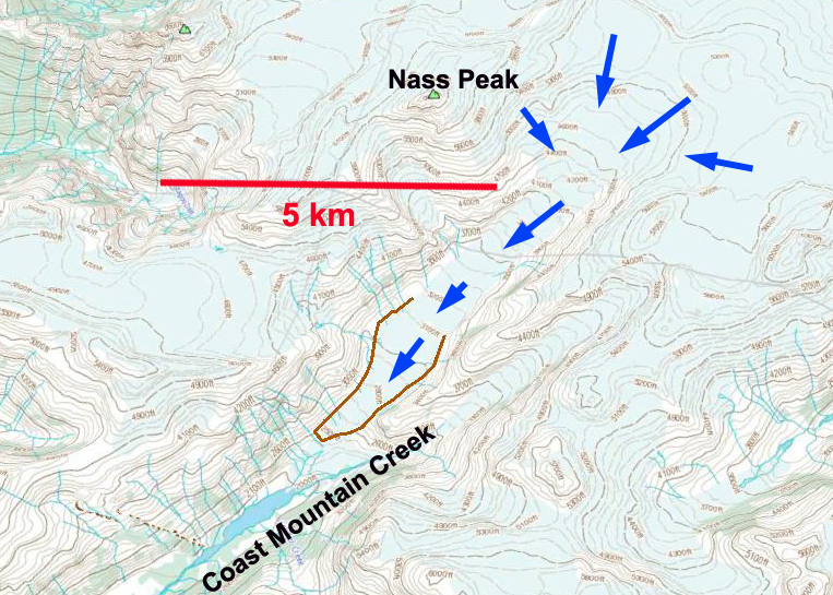 Here we examine changes in the is glacier in Landsat imagery from 1986 to 2013. In 1986 the glacier terminated at the red arrow, this is also approximately the mapped terminus position. The terminus is near the nose of a long ridge at 650 m in 1986. By 1997 the glacier had retreated 800 m to a location adjacent to the southern outlet stream from another glacier in a side valley. By 2010 the glacier has retreated behond the northern outlet stream of the side glacier, pink arrow and almost too the yellow arrow. In 2013 the glacier has retreated just beyond the yellow arrow a distance of 2000 meters since 1986 and is at an elevation of 850 m. For a glacier that was 7.5 km long and is now 5.5 km long that is a 27% loss of length in 27 years. The green arrow point to the separation between a side glacier and the Nass Peak Glacier, this expanded 250 m both from retreat of the side glacier and the lateral thinning at this elevation of Nass Peak Glacier. The last image is a 2009 Google Earth Image indicating the mapped terminus outline to the 2009 terminus.
The Nass Peak Glacier retreat is larger as a percentage of the glacier, but similar in distance than the nearby Porcupine Glacier, BC, Bromley Glacier, BC, Jacobsen Glacier, BC, Chickamin Glacier, AK and Patterson Glacier, AK. Nass Peak Glacier also has lacked a proglacial lake which typically enhances retreat via calving, making the retreat quite significant in terms of surface mass balance loss.
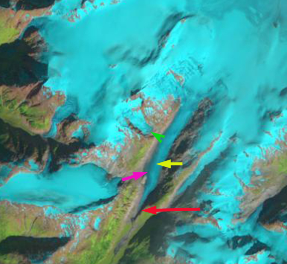
1986 Landsat Image
1997 Landsat Image
2010 Landsat Image
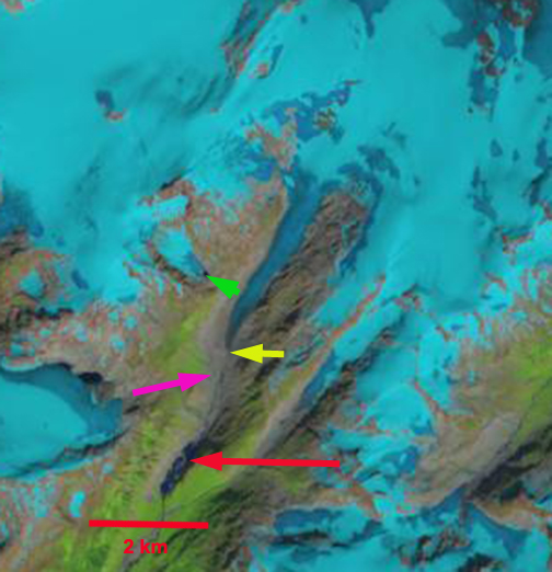
2013 Landsat Image

2009 Google Earth Image
 Dean of Academic Affairs at Nichols College and Professor of Environmental Science at Nichols College in Massachusetts since 1989. Glaciologist directing the North Cascade Glacier Climate Project since 1984. This project monitors the mass balance and behavior of more glaciers than any other in North America.