
June 22, 2013
Jaonli Glacier Thinning and Retreat, Uttarakhand India
Posted by Mauri Pelto
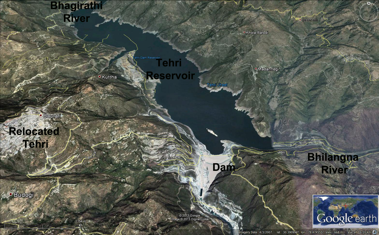
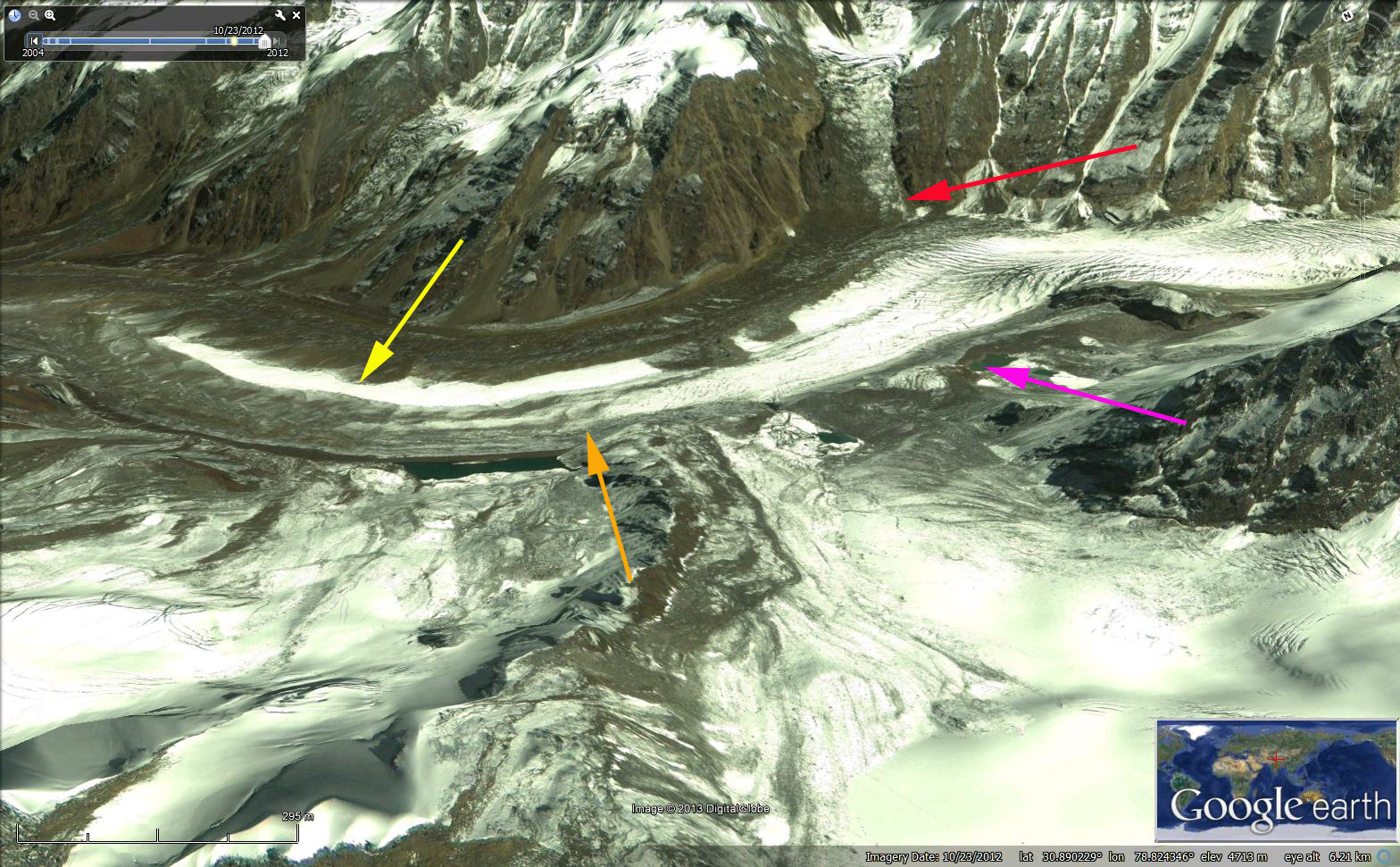
Jaonli Glacier is in the Pilang basin which feeds the Bhagirathi River in Uttarakhand. The glacier is 20 km west of the well known Gangotri Glacier and 30 km east of Jaundhar Barak. The glacier is one valley north of the well studied Dokriani Glacier. Jaonli has a heavily debris covered terminus which slows the retreat of the actual terminus, while upglacier thinning has been quite rapid. Here we examine Landsat imagery from 2000 to 2012 to illustrate the change due to increased melting. The glacier provides hydropower as it passes three Hydropower plants generating 1430 MW, including the 1000 MW Tehri Dam and reservoir, which also provides flood control, such as this past week of June 17, 2013(second image). The Tehri Reservoir level rose 25 m within 48 hours which is a storage of approximately 1.3 billion cubic meters. Jaonli Glacier is a heavily avalanche fed from the huge wall of rock on its northeastern flank, as noted by light blue arrows. In each image the yellow and orange arrows indicate the same location for comparison of the width of debris cover. The purple and red arrow indicate where two tributaries flow down to meet the Jaonli Glacier.
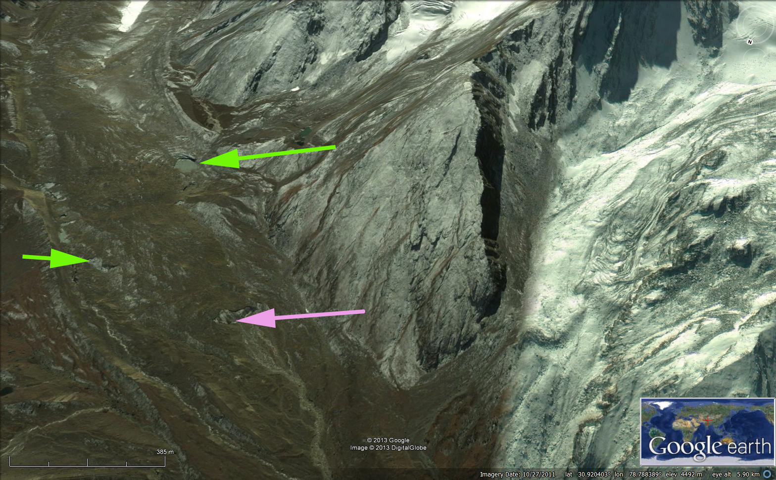
In 2000 the clean ice region of the main valley tongue of the Jaonli Glacier is 400 m wide at the yellow arrow and 500 m wide at the orange arrow. The eastern tributary at the red arrow joins the main valley glacier. At the purple arrow two small ponds are developing as the tributary that does not reach Jaonli melts back. By 2012 the debris free ice surface is 100 m wide at the yellow arrow and 200 m wide at the orange arrow. The debris cover spreads across the glacier as the clean ice melts faster thinning, and the debris covered area is then on an increasingly wide and high ridge above the clean ice and the debris then falls and oozes down onto the cleaner ice. The tributary at the red arrow still reaches the main glacier but is now covered by debris. The two ponds have merged at the purple arrow to create a larger terminus lake. IN Google Earth the images are from 2011. The first is a cross ice view towards the red arrow tributary, indicating the same locations and the extent of the debris cover. The second image is a closeup of the terminus, with a pink arrow indicating the 2011 terminus, note river issuing here and large ice face. However, there are two other developing termini with lakes forming 1 km upstream of the main terminus, green arrows. This stagnant ice in between will continue to melt and collapse. The glacier has retreated 160 m from 2000 to 2012, but will undergo an additional one kilometer retreat to reach the lake locations. This glacier fits well the overall retreat in the region (Kulkarni et al, 2007).Dokriani Glacier retreated at a rate of 17 m/year from 1962-2000 (Bhambri and Bolch, 2011). In the nearby Tons River Basin Mehta et al (2013) noted the 1962-2010 retreat of three glaciers Jaundhar (34 m/year), Jhajju (15 m/year) and Tilku Glacier (13 m/year). 

 Dean of Academic Affairs at Nichols College and Professor of Environmental Science at Nichols College in Massachusetts since 1989. Glaciologist directing the North Cascade Glacier Climate Project since 1984. This project monitors the mass balance and behavior of more glaciers than any other in North America.