
June 6, 2013
Excelsior Glacier Retreat, Alaska
Posted by Mauri Pelto
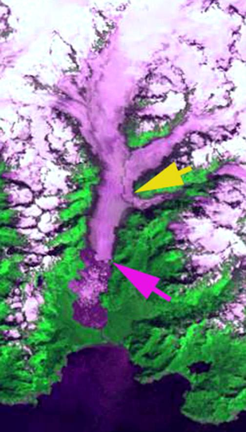
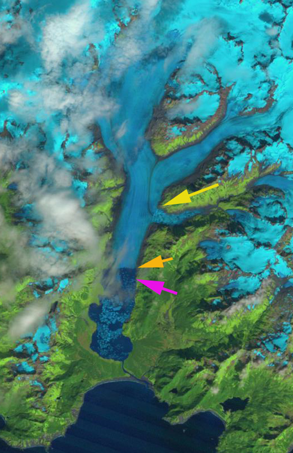
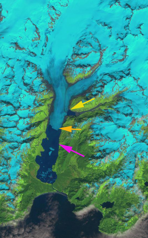
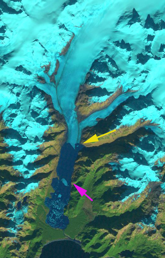
Excelsior Glacier in Alaska has terminated in a lake for the last century. 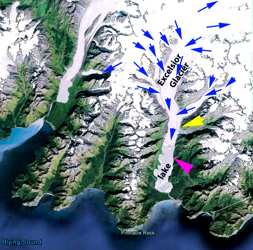 Here we examine the retreat of this glacier from 1984 to 2011 using Landsat imagery. This glacier is seen as a model for the impending retreat of Brady Glacier examined in a paper we just published (Pelto et al, 2013). In 1909 the glacier ended on the strip of forested land between the lake and the ocean (Molnia, 2007). By 1950 the glacier had retreated 2 km from this strip of land creating the new lake (USGS-Molnia, 2008) In 1909 the glacier had ended on land at the south end of the lake, indicating a retreat of 4.5-5.0 km in approximately a 75 year period. In 1984 (first image below) Excelsior Glacier ended at the pink arrow and the lake extending beyond the terminus was 4.7 km long, the yellow arrow indicates the 2011 position and just south (under) the arrow is a glacier dammed lake. The lake width has changed little and is 1.4-1.8 km wide in the region the terminus has been retreating through during the last 30 years. By 1989 the glacier had retreated 500 m and the lake was filled with numerous icebergs. By 2001 the glacier had retreated 1500-1700 m from the 1984 position, a rate of 100 meters per year, and the glacier dammed lake south of the yellow arrow is still apparent, as are a couple of large icebergs. The 2003 Google Earth image indicates further retreat and again a couple of large icebergs and a large crack near the center of the terminus indicating a new iceberg getting ready to separate. By 2011 the glacier had retreated past the formerly glacier dammed lake and ended at the prominent ridge just north of this former lake and the new inlet that replaces it. The glacier has retreated 3400-3700 m depending where on the front the measurement is made. This is a rate of over 100 meters per year since 1984.
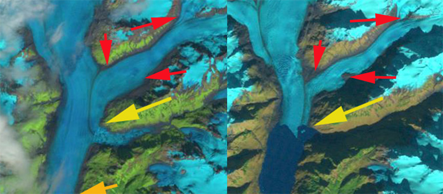
Another big change is the thinning and narrowing of the tributary entering on the east side of the glacier north of the terminus. This is illustrated in the last image with a combined 1989 image left and 2011 rigth and the red arrows pointing out three significant points of thinning and new rock-moraine exposure. This glacier has behaved in a similar fashion to so many Alaskan glacier from the nearby Bear Glacier, to British Columbia’s Melbern Glacieror Porcupine Glacier and southeast Alaska’s Chickamin and Norris Glaciers of southeast Alaska
1984 Landsat Image
1989 Landsat image
2001 Landsat image

2003 Google Earth image
2011 Landsat Image
1989-2011 Landsat image
 Dean of Academic Affairs at Nichols College and Professor of Environmental Science at Nichols College in Massachusetts since 1989. Glaciologist directing the North Cascade Glacier Climate Project since 1984. This project monitors the mass balance and behavior of more glaciers than any other in North America.