
May 8, 2013
Puisortoq North Glacier Retreat Southeast Greenland
Posted by Mauri Pelto
Puisortoq North Glacier southeast Greenland has experienced an increased rate of retreat since 2000. The retreat is expanding a fjord that begins just north of the Puisortoq Peninsula and west of the Otte Rud Island. 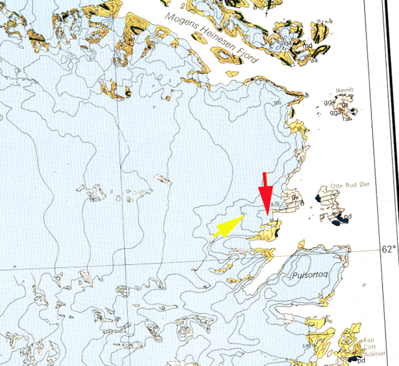 In the assessment of Greenland glacier terminus change by the Glacier Dynamics Group, at Ohio State University Howat and Eddy (2011) observed the glacier retreat as 20 m in the 1990’s and 2 kilometers from 2000-2010. Of the 90 glaciers in southeast Greenland examined, 90% retreated, with an average rate of 107 meters per year from 2000 to 2010.
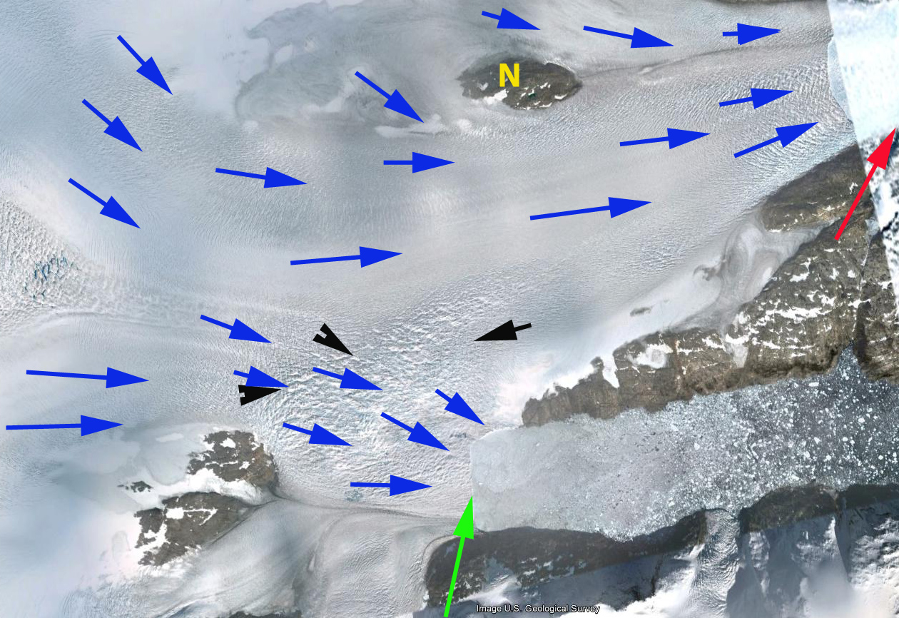
In this post we examine imagery from 1999, 2000, 2004, 2009, 2010 and 2012 to portray the terminus change. The red arrow in each image indicates the 1999 and 2000 terminus position, which coincides with a prominent feature on both the north and south side of the fjord. The Yellow N denotes a nunatak. In the 1999 and 2000 Landsat imagery the nunatak is 5.2 kilometers from the ice front, at the calving front the fjord is 2.1 kilometers wide. By 2004 in a Google Earth image the glacier nunatak is 4.0 kilometers from the ice front and the fjord at the calving front is 2.4 kilometers wide. This is a 1.2 kilometer retreat in four years. By 2010 Landsat imagery indicates, the nunatak is 3.5 kilometers from the ice front. By 2012 the ice front is 3.2 kilometers from the ice front. The retreat from 2000 to 2012 is 2 kilometers, just as Howat and Eddy (2011) noted. The fjord at the calving front is now 2.7 kilometer wide and will expand to 3.1 kilometers wide as the glacier retreats another 700 meters. The increasing width of the calving front, will increase the calving rate encouraging continued rapid retreat at least until the nunatak is reached after a further 3 kilometers of retreat. The complicating feature in this case is a separate terminus on the south side of the glacier, green arrow, that seems to be capturing part of the flow of the Puisortoq North Glacier and could well merge with the northern terminus, red arrow, after a 4 to 5 km retreat. In the last image the blue arrows indicate flow paths, and the black arrows a chaotic region of crevassing, where the stresses are pulling the ice in different directions. This glaciers behavior is similar to that of Thyrm Glacier and Apuserajik Glacier
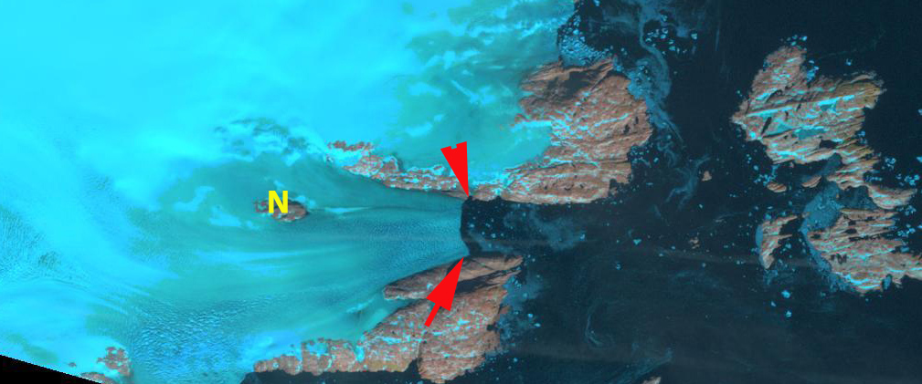
1999 Landsat Imagery, red arrows indicate 1999 terminus location.
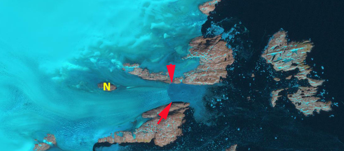
2000 Landsat Imagery, red arrows indicate 1999 terminus location.
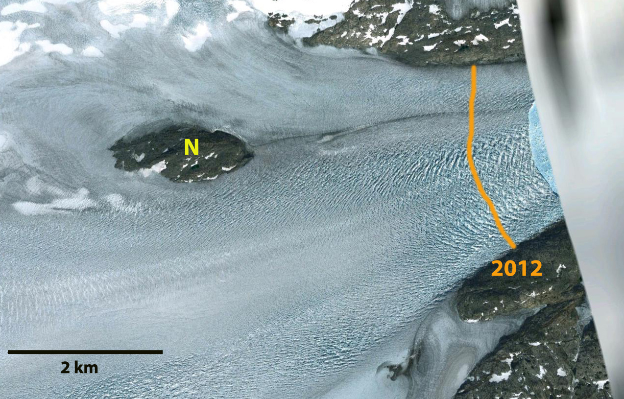
2004 Google Earth Imagery, orange line 2012 ice front
2009 Geoeye Imagery

2010 Landsat Imagery, red arrows indicate 1999 terminus location, orange line ice front..

2012 Landsat Imagery, red arrows indicate 1999 terminus location, orange line ice front
 Dean of Academic Affairs at Nichols College and Professor of Environmental Science at Nichols College in Massachusetts since 1989. Glaciologist directing the North Cascade Glacier Climate Project since 1984. This project monitors the mass balance and behavior of more glaciers than any other in North America.