
May 1, 2013
Hidden Creek Glacier Thinning, North Cascades, Washington
Posted by Mauri Pelto
Hidden Creek Glacier is northeast of Baker Lake on the west slope of Mount Hagan in the North Cascades of Washington. We began measuring the retreat of this glacier in 1985, with periodic visits since. 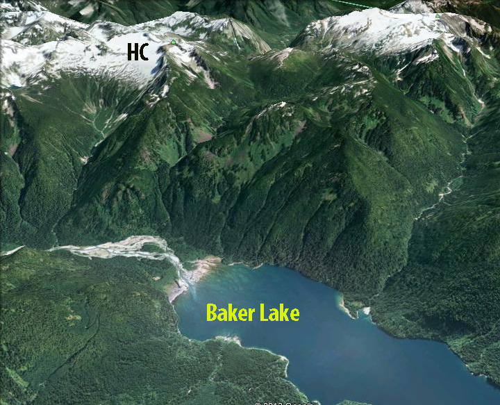 Pelto and Hedlund (2001) examined the terminus response time of 38 North Cascade glaciers, where we could determine the terminus history for the 1890-1998 period. The glaciers exhibit three distinct patterns (Table 3): 1) Retreat from 1890 to 1950 then a period of advance from 1950-1976, followed by retreat since 1976. 2) Rapid retreat from 1890 to approximately 1950, slow retreat or equilibrium from 1950-1976 and moderate to rapid retreat since 1976. 3) Continuous retreat from the 1890 to the present. Hidden Creek is a type 2 glacier.
Here we examine photographs of the glacier to identify changes from 1979 to 2010. The burgundy arrow indicates the rock outcrop between the upper northern part of the glacier and the lower southern part of the glacier. In 1979 there is one small outcrop of rock between the upper and lower part of the glacier, the glacier has numerous extensively crevassed regions. From 1985-1990’s this one outcrop remained visible but did not notably change, as seen in the 1998 and 1999 image below. By 2006 and 2007 a network of outcrops had emerged, as the upper glacier became increasingly separated from the lower and southern section of the glacier. By 2009 the outcrops had merged into two large outcrops 270 m across, the main terminus had retreated only 50 m from 1979 to 2011, but the thinning of the glacier indicates much more significant changes to come. The thinning of the upper glacier indicates a glacier that cannot survive current climate, though it is not disappearing rapidly (Pelto, 2010). In 2010 the early August image indicates the extent of the rock outcrops that have still not melted out from the previous winter snows. We will be interested to see the glacier again this summer when we head to the field. This glaciers response is similar to Quien Sabe Glacier and Daniels Glacier.
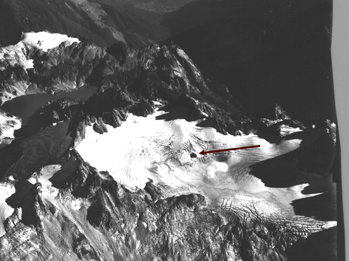
1979 Photograph from Austin Post (USGS)

1998 Google Earth image
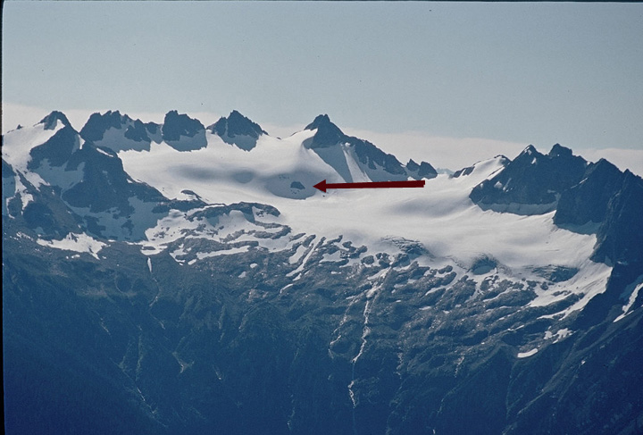
1999 image taken from Ptarmigan Ridge

2006 Google Earth image
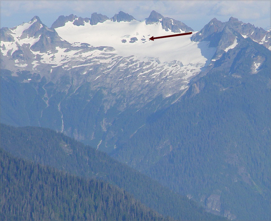
2007 image taken from Ptarmigan Ridge

2009 Google Earth image

2010 Hidden Creek Glacier from right below the glacier
 Dean of Academic Affairs at Nichols College and Professor of Environmental Science at Nichols College in Massachusetts since 1989. Glaciologist directing the North Cascade Glacier Climate Project since 1984. This project monitors the mass balance and behavior of more glaciers than any other in North America.