
December 1, 2012
Jones Ice Shelf Loss, Antarctica
Posted by Mauri Pelto
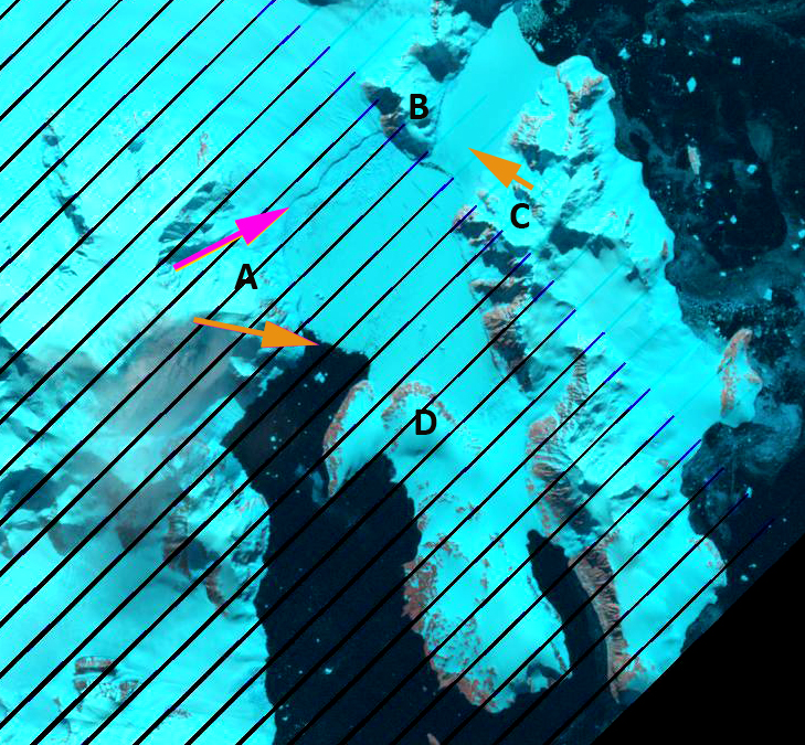
The Jones Ice Shelf was midway up the west coast of the Antarctic Peninsula. The ice shelf (red arrow) was smaller than other ice shelves that have mostly or substantially disintegrated Wordie Ice Shelf (orange arrow), Larsen B Ice Shelf (pink arrow) or Wilkins Ice Shelf (green arrow).  The British Antarctic Survey (BAS), has been observing the changes in ice shelves around the Peninsula Cook and Vaughan, (2010) and Fox and Vaughan (2005). The BAS noted that the ice shelf had an area of 29 square kilometers in 1980, by 1990 21 square kilometers and 10 square kilometers in 2000 and 2003, gone. Blaicklock Island (C and D) and the Arrowsmith Peninsula (A and B) are now separated by open water in Jones Channel. Cook and Vaughan (2010) also note that this was not the result of a long ongoing retreat, the Jones Ice Shelf expanded 20 % between 1947 and 1978. In the post below there is a sequence of images from Landsat and Google Earth imagery in a sequence as follows, 1989, 1991, 1999, 2009 and 2011. The Ice shelf exists in 1989 and 1991, ending at the orange arrows, which are included in the 2009 and 2011 images as well for comparison. Points A-D are in the same location in each image. The 1999 image indicates a disintegrating Jones Ice Shelf (JIS), with a small ice tongue protruding part way across Jones Sound, the new waterway that has opened. By 2009 the glacier has retreated out of the Jones Channel to the pink arrow and red line in 2011. The eastern terminus retreated 4 km and the western terminus 7 km. The ice shelf loss here is similar in magnitude to Rohss Bay on James Ross Island.


 Dean of Academic Affairs at Nichols College and Professor of Environmental Science at Nichols College in Massachusetts since 1989. Glaciologist directing the North Cascade Glacier Climate Project since 1984. This project monitors the mass balance and behavior of more glaciers than any other in North America.