October 25, 2012
Tirich Mir Region Glacier Retreat, Pakistan
Posted by Mauri Pelto
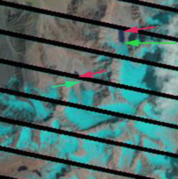
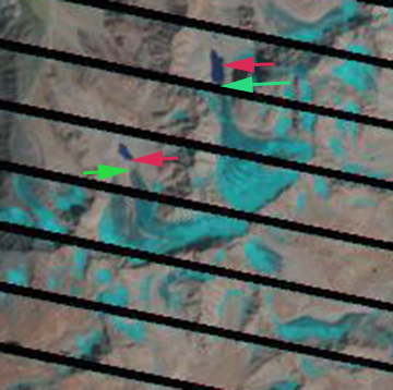
Tirich Mir is the highest mountain in the Hindu Kush and is in the northwestern corner of Pakistan. Here we examine Google Earth and Landsat imagery from two glaciers off the southwest ridge of Tirich Mir. The two glaciers are unnamed and are in the Dir Gol Valley, that starts in Akari, Pakistan and drains the southwest side of Tirich Mir, red arrows.  A 2000 Landsat image (top image) indicates both glaciers ending in small lakes. The arrows in all images are purple for the lack of snowcover even in the glacier accumulation zone, red for the 2000 terminus, yellow for the Google Earth terminus and green for the 2011 terminus. By 2008 the Google Earth imagery indicates that the eastern of the two has retreated 400 meters leading to a more than doubling of the lake size. For the western glacier, the glacier still maintains has just retreated from the lake margin. The lake is slightly larger than in 2000. There is no snowpack on either glacier in the Google Earth imagery or in the 2000 image even at 5000 meters. This indicates glaciers without persistent accumulation zones, which means they cannot survive (Pelto, 2010).
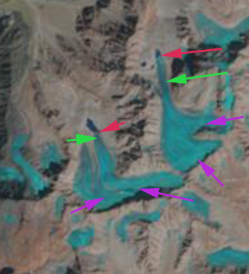
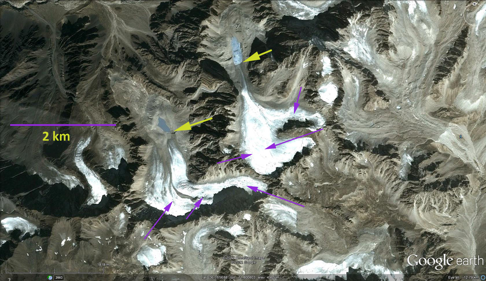
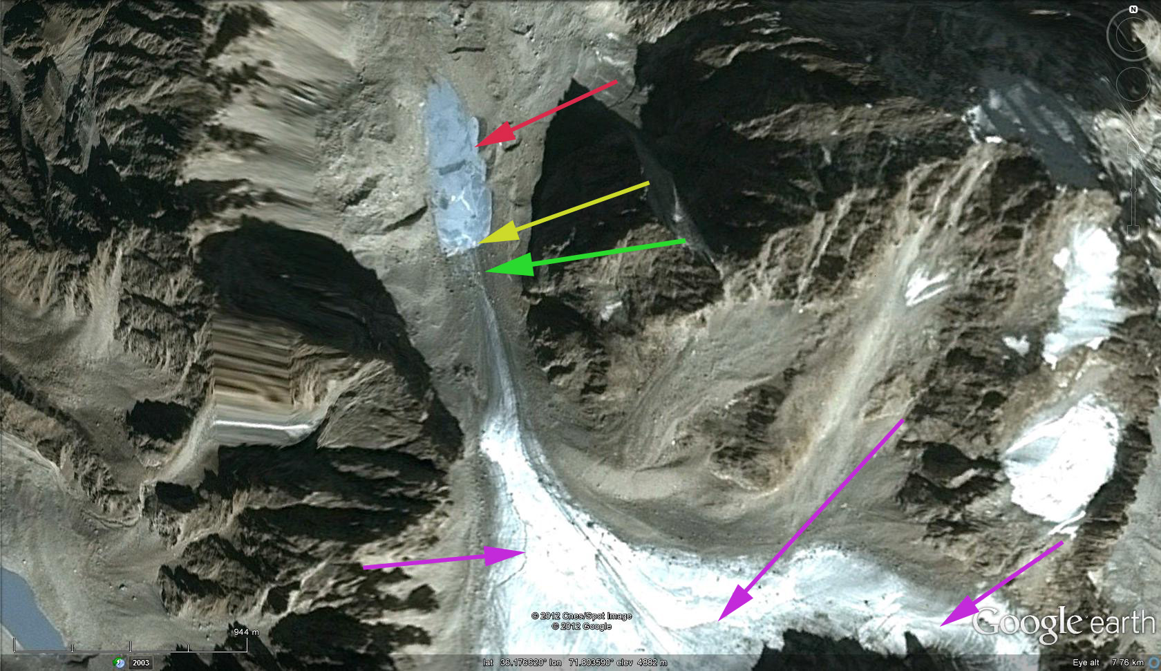
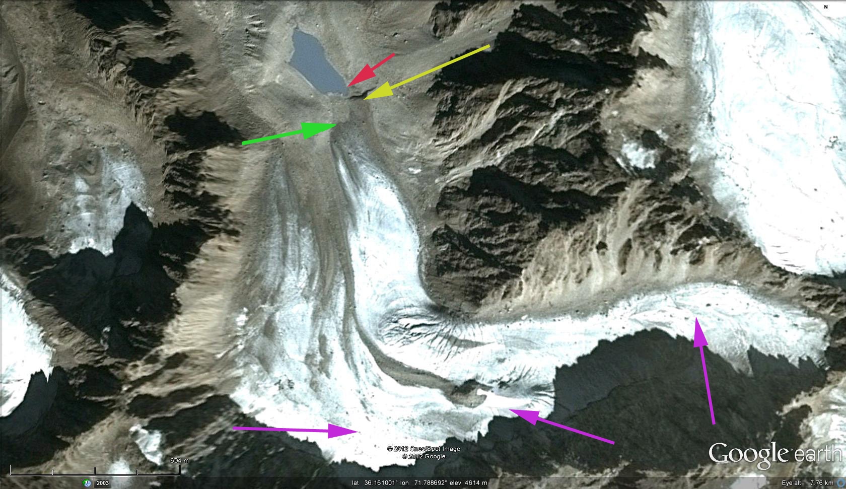 By 2010 and 2011, last two images. The eastern glacier has retreated an additional 100 meters and the lake is still expanding. The western glacier is no longer in contact with the lake, the terminus is now 150 m from the lake. The retreat from 2000-2011 of the eastern glacier has been 500 meters and 200 meters for the western glacier. The rretreat is similar to that of Godur Glacier in the Swat Valley. After 2000 76% of the glaciers in the region have been retretaing (Sarikaya et al, 2011). Around Tirich Mir glacier retreat had been relatively low up to this point. Most of the glacier in this region of the Hindu Kush


 Dean of Academic Affairs at Nichols College and Professor of Environmental Science at Nichols College in Massachusetts since 1989. Glaciologist directing the North Cascade Glacier Climate Project since 1984. This project monitors the mass balance and behavior of more glaciers than any other in North America.