May 18, 2010
Vista Glacier, Glacier Peak WA Retreat
Posted by Mauri Pelto
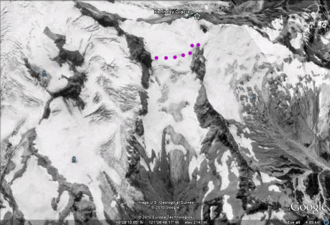
Vista Glacier is the northernmost of the large valley glaciers on the east side of Glacier Peak. The glacier begins at 2475 m beneath Kennedy Peak. We examined all of the glaciers around Glacier Peak in detail in the 1990’s to document their changes since observed by C.E. Rusk 100 years earlier. The glacier during the LIA joined the Ermine Glacier and extended down to 1345 m. By 1900 when Asahel Curtis photographed this glacier it had retreated 1300 m. By 1946 the glacier had retreated an additional 600 m separating from Ermine Glacier to a minimum at 1900 m. In 1955 the glacier began a slow advance that had ended by 1975 with a total advance of 105 m. In 1985 at our first visit the glacier was again retreating, total retreat was 10-20 meters from the advance moraines. By 1994 the glacier had retreated nearly 100 m and by 1997 had retreated to the 1946 position. The retreat has continued and by 2006 the glacier had retreated 300 meters from its 1975 advance position. This glacier like all 47 glaciers we observe in the field in the North Cascades is continuing a significant retreat. Below is a sequence of images from the 1984 map, 1996 aerial photograph, and the 2006 satellite image. The latter has the orange 1975 terminus position noted, the purple line on the 2006 image is the current terminus. The dotted purple line on the aerial photograph marks the area that consistently retains accumulation.
1984 USGS Map of Vista Glacier
1994 Image of Vista Glacier indicating the consistent accumulation zone.
In 1994 Cliff Hedlund and I were surveying the terminus when we found a beautiful ice cave beneath the glacier. The rock just behind Cliff in the cave is apparent now out in the open in the 2006 satellite image. We surveyed the position in 1994.
The lower several hundred meters of the glacier are uncrevassed indicating limited flow on this fairly steep slope.
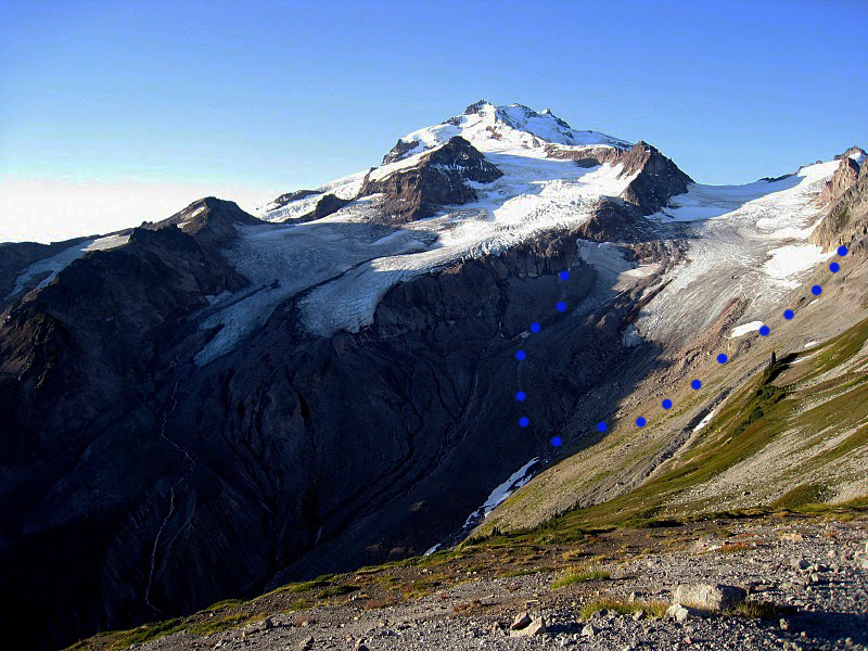
The arrow in the picture above indicates the ice surface level in 1985, the glacier has thinned 20 meters in this region. A view of the glacier from indicates the recession better, the blue dotted line is the ice margin in 1975. The picture below is from Sept. 2009 the lack of snowpack on the lower 70% of the glacier is evident. The blue dotted line is the glacier margin in 1975, and in 1985 it had changed little. This advance left a very evident moraine that will deteriorate with time.
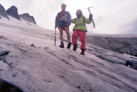
Measuring snow depth up the middle of this glacier in 1994 and 1997 we found limited areas with accumulation of greater than 2 m in early August. Note the annotated aerial photograph showing consistent snow covered area. This makes the glacier prone to losing most of its snow cover in many years such as occurred 2005 or 2009. This indicates considerable retreat will occur even with present climate. The last image is Cliff Hedlund and I on glacier in 1994, Cliff unfortunately is no longer with us, but was a great field companion and the only person I knew who could create a good spear point from rock using an antler.


 Dean of Academic Affairs at Nichols College and Professor of Environmental Science at Nichols College in Massachusetts since 1989. Glaciologist directing the North Cascade Glacier Climate Project since 1984. This project monitors the mass balance and behavior of more glaciers than any other in North America.